From Scilly to Dartmoor – gigs to Tors

I’ve been really lucky!

I have been involved with two of the largest mass participation outdoor sporting events in the south west. Last week I competed in the Isles of Scilly World Gig Rowing Championships (see here, here and here) and today I’m off to the 2016 Ten Tors Challenge event.

I’m the Team Manager for the National Trust on Dartmoor (I’m now a volunteer but was previously the NT’s General Manager on the Moor). We have three teams – 35, 45 and 55 milers. We have been training for the last nine months with Torquay Boys Grammar School preparing 18 young people for the challenge. Yesterday teams of staff and volunteers from the NT and TBGS prepared the base camp (there was even a cuckoo urging everyone on). Today we have a day of briefing and preparation. The main event starts at 7am on Saturday morning.

Training has been tough this year – we have been out torrential amber warning rain and winds – see here and cold nights – see here. The teams are therefore ready to go and amazingly the weather forecast looks very good i.e. not raining and cold. Yippee.

TT pass
I collected my car pass from Okehampton Camp today after having collected the teams and volunteers ‘event’ hoodies.

Wild Tribe 55
Here is National Trust Wild Tribe 55 mile last year mid event with the Brigadier and a helicopter! How cool is that.

10 Tors 24-Jan 1
Sunset during a training walk – what a time to be on the moor

10 Tors is brilliant for young people – it teaches them two sets of life skills:-

  1. A love of the outdoors, nature and landscapes – it gets them away from their ‘screens’ for while.
  2. It also gives them fitness, grit and determination, teaches them teamwork and encourages leadership and achievement.

Just what the National Trust is trying to encourage by its support of the Wild Network.

Thank you Torquay Boys Grammar School (and Dr. Roy Colvile and Tony Owen in particular) without you the National Trust couldn’t do 10 Tors.

Around Cuckoo Rock

On Sunday we were check pointing our 10 Tors teams at Norsworthy Bridge at the eastern end of Burrator Reservoir. We had a bit of time on our hands so we went for a short walk up to Cuckoo Rock.

Cuckoo Rock
Cuckoo Rock is a large boulder below Combshead Tor – its name is shrouded in mystery – some say the top of the rock looks like a cuckoo. Maybe. The area around the rock however is very suitable for cuckoos with lots of ‘perching’ trees and a lot of meadow pipit habitat. I have seen and heard cuckoos here in the past (they will be back within a month!) Cuckoo Rock in the past was said to be a place where smuggled goods were hidden and today it is a popular place for bouldering – a form of technical low level climbing. See here for more stories about Cuckoo Rock.

Cuckoo Rock panorama
From Cuckoo Rock there are some great views of Dartmoor – looking west with Sheeps Tor poking out above the trees

Narrator Brook 1
Looking east up the Narrator Brook

Narrator Brook 2
A lovely wooded valley as it approaches Burrator Reservoir

Leather Tor
Great views of Leather Tor in the foreground the Sharpitor behind

Burrator Res
On the way back to Princetown we stopped so I could photograph Burrator Reservoir

The walk to Cuckoo Rock from Norsworthy Bridge is an easy one – it is around 2 miles out and back along an obviously defined path. There is a car park at Norsworthy Bridge and the track starts on the eastern edge.

Grey and cold but dry

The past weekend saw our penultimate training walk for this year’s 10 Tor’s Expedition. It was a cold and grey weekend but fortunately it stayed dry for both days. National Trust Wild Tribe had all our 35, 45 and 55 mile teams out with Torquay Boys Grammar School’s team – seven in total. Our role as moorland leaders for the groups is now to shadow and checkpoint them, i.e. we are not now walking directly with them we are keeping an eye on them to make sure all is well.

Hen Tor
My first task with Pete Davies was to check point Trig 492 in the south west of the moor on the edge of the National Trust’s Upper Plym Estate – a bleak, exposed and remote place. This involved a 1200 foot climb up from the Blackabrook across acres of tussocky Molinia grassland. We went via Little Trowlseworthy Tor pictured above with Hen Tor in the background. Luckily we weren’t there for long as all the groups were making good progress but we did have to bring down a team member who was unwell.

Pink granite
Here is a piece of ‘pink’ granite at Little Trowlesworthy Tor – rare and much sought over in the past  – the reason for the quarry there.

Wild campingWe wild camped near the O Brook not far from Combstone Tor – of course we missed the rugby ….. but we did survive the bitter night

Combestone TorCombestone Tor west of Venford Reservoir

Fox Tor Cafe

Next morning after seeing the teams off some of us had an early breakfast in the Fox Tor Cafe in Princetown – it was very busy at 8am – full of 10 Tors leaders and managers – there were 250 10 Tors teams out on the moor practicing over the weekend! (Those who were checking pointing first thing got a late breakfast once we had taken over their duties)

South Hessary 2
Heading up to South Hessary

South Hessary
where we met all our 45 and 55 mile teams.

Overall a very successful weekend – all the teams got some big miles into their legs and gained lots of confidence.


Mend Dartmoor

The British Mountaining Council (BMC) has launched a campaign to raise £100,000 to repair various footpaths in national parks around the country. One of the projects is on Dartmoor – the footpath and bridleway that runs from Princetown down to Ditsworthy Warren. The track is well used by walkers and mountain bikers. The section from Nunn’s Cross south is in a particularly poor condition.

Here is a video about the project that has been produced by the Dartmoor National Park Authority.

Nunns Cross FarmThis is part of the track in question at Nunn’s Cross Farm

Nunns Cross Farm 1

The track is widely used by people training for 10 Tors and I can certainly confirm that parts are very difficult to walk now and as a result most people walk off the track creating erosion in new areas.

I will support this as that will help make the DNPA’s money go further – here is the link if you want to help too.

Wild daffodils and an access problem

Last Sunday I went for a walk to Cod Wood to see how the wild daffodils were doing. I parked up at Steps Bridge and took the permissive path along the river to Cod Wood.

Wild daffodils - Cod Wood 1
A lot of daffodils are now in flower – I reckon next weekend will see the peak

Wild daffodils - Cod Wood 2
Quite a few plants not yet in flower

Wild daffodils - Cod Wood 3
 Through to the canopy

Cod Wood 1
There was a strange mist in the conifer blocks

Cod Wood - access
It might have been the last time I do this walk as this sign was on the gate by the Steps Bridge car park

This is not the first time that this situation has arisen. The Dartmoor National Park Authority pay the landowner to allow access through the woods so that the National Trust and Woodland Trust woods beyond can be reached. This sign appears to suggest that no agreement for the future has yet been reached and therefore the gate will be locked on April Fool’s Day.

In the times of austerity the DNPA has a lot less money than it used to have and therefore reaching agreements like this and being able to pay for them is much more difficult.

UPDATE: I have now been contacted by three reader of my blog who have told me that the reason that the access agreement is ending is not as a result of financial wranglings between the owner and the DNPA. Apparently the owner is fed up with anti-social behaviour by a minority of people using the permissive path (e.g. dog fouling, littering, abusive comments etc). As a result he has had enough and who can blame him.

I wonder whether there might be another solution.

Access map

The area hatched in red is the piece of woodland where the access agreement is in place – beyond the red area the woods are owned by the National Trust. The National Trust also owns the woodland to the north of the River Teign – marked as ‘Meadhaydown  Wood (Nature Reserve)’ and known as Dunsford Nature Reserve.  It leases this to the Devon Wildlife Trust. There is a well used track through the nature reserve by the river. Perhaps a long term solution might be to build a footbridge across the Teign from the Dunsford Nature Reserve into Cod Wood? It would be expensive in the short term but would solve the access problem once and for all. There of course might be very good reasons why this is a bad idea (e.g. impact on wildlife, impact on Dunsford Nature Reserve and aesthetics) but perhaps it is worth exploring.

A walk on Belstone Common

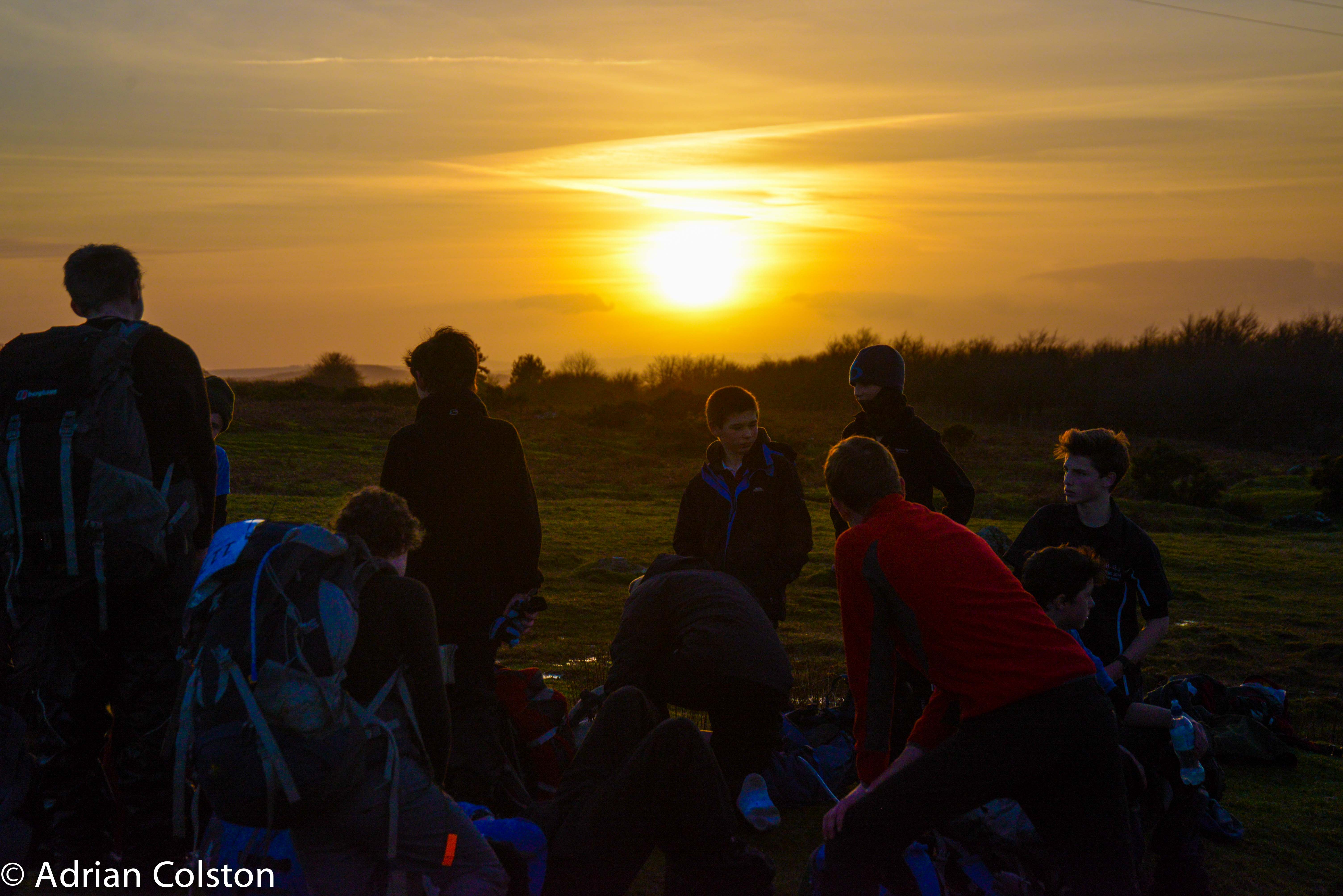
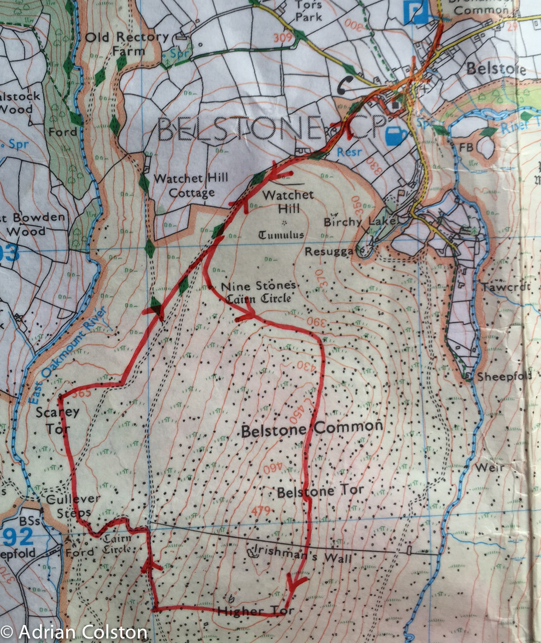
Yesterday the weather was fabulous so I decided to go for walk on Belstone Common and take some photographs. I have decided to write it up in some detail and provide a map as the walk makes an ideal introduction to high Dartmoor walking. My route is around 7km long – it does go up and down a bit but it isn’t that strenuous or that boggy. As ever my advice is to wear walking boots, proper clothing and take a compass and map. Pick a clear dry day with a good forecast and you should be fine. If you do get lost just head north and you should end up funnelled back to Belstone.

Belstone Walk
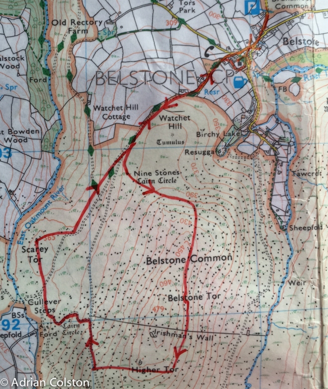
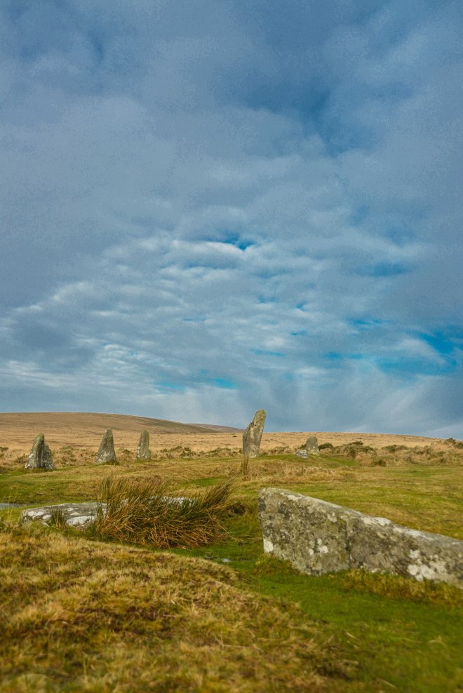
It is a circular route starting from the car park just outside Belstone which is situated on the north side of the moor between Sticklepath and Okehampton on the old A30 which now seems to be called the B3260. Walk into the village and past the old red telephone box (which now contains a defibrillator and not a phone) and walk up the hill past the Water Treatment Works onto the moor. Walk along the enclosure wall on your right and when that kinks to the west keep going for a couple of hundred yards looking for a small track / path going to the left. You should then see the first stop on the walk – the Nine Maidens stone circle.

Nine Maidens
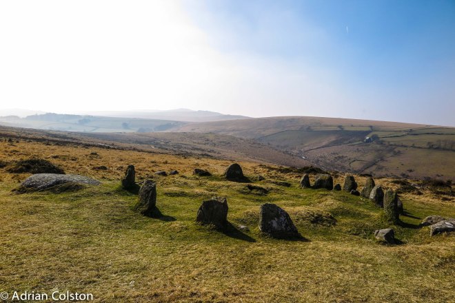
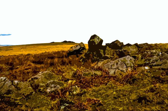
The Nine Maidens with Rowtor, West Mill Tor and Yes Tor on the skyline in the haze.

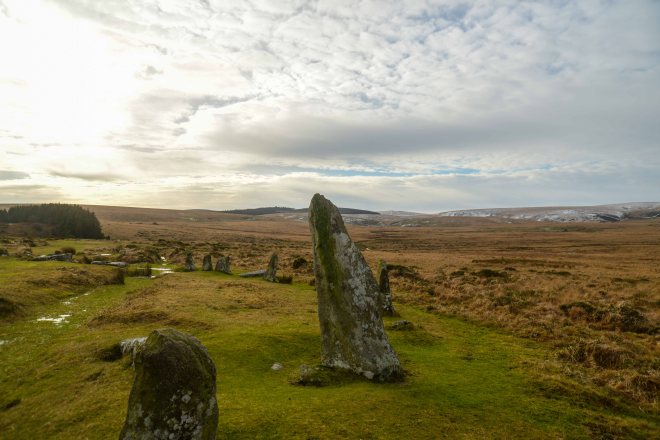
It is in fact a cairn circle – at the centre there would have been a burial chamber known on Dartmoor as a kistaven. This is therefore a burial spot – earth would have been piled over the circle to cover the burial chamber. The kistaven has long been pillaged and all the remains now is the stone circle. Myths and legends abound around the Nine Maidens (marked on the OS Map as the Nine Stones). A very detailed account of these can be found on the excellent Legendary Dartmoor site – see here. In summary nine maidens were dancing on the Sabbath and as a result were turned to stone, unfortunately there are 17 stones in the circle …. so it is sometimes called the 17 brothers who came to a similar fate as the maidens. There are also tales of witches and the moon. Take your pick.

Hawthorn and Belstone Tor
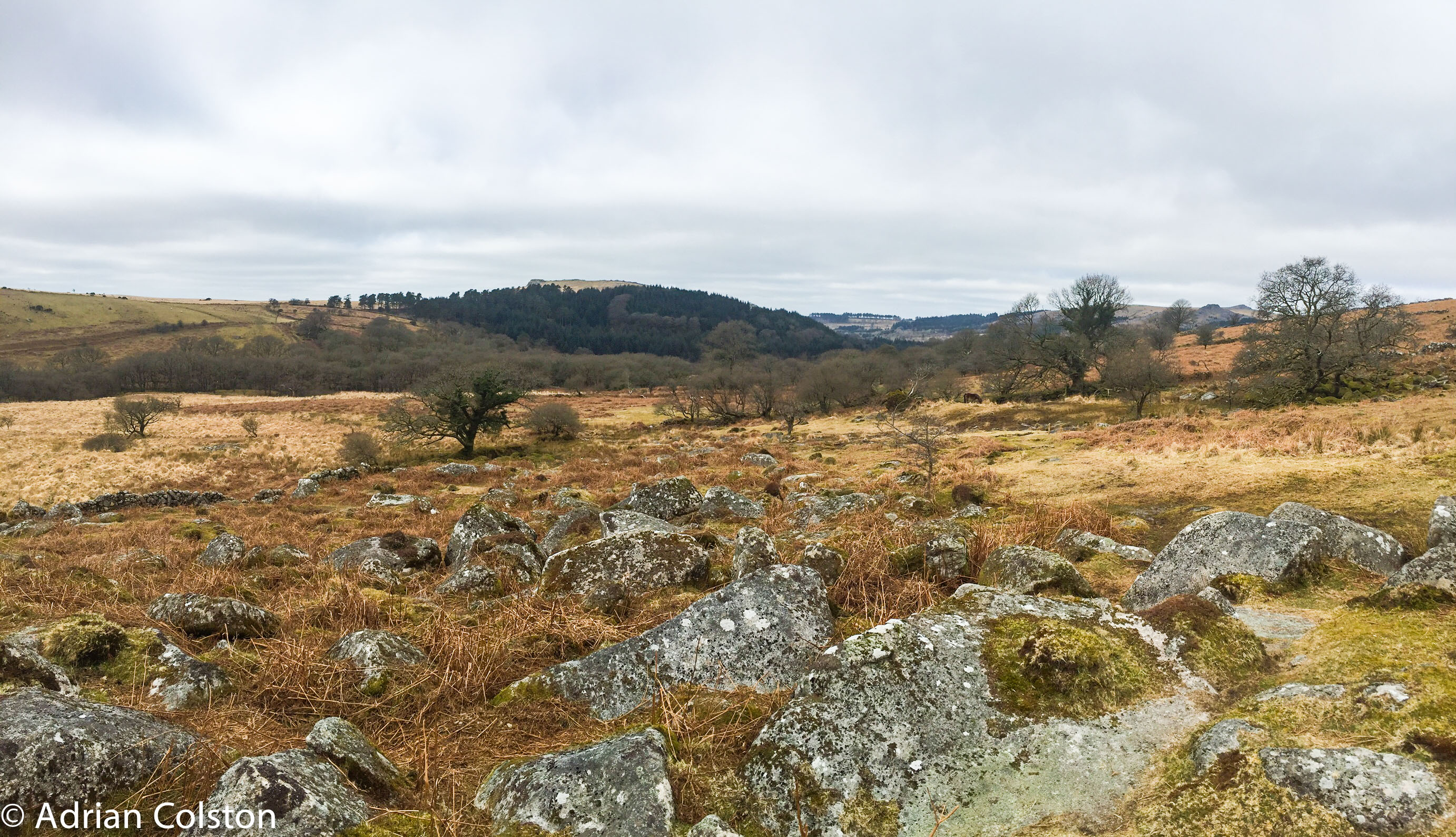
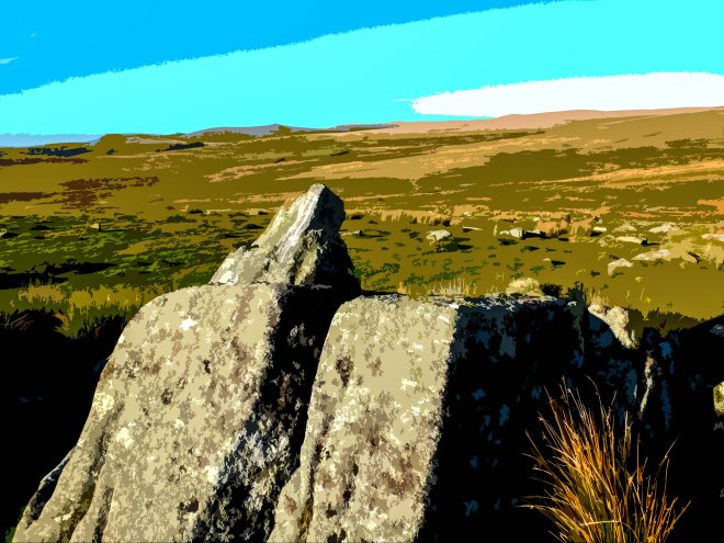
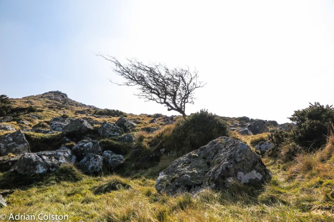
Just on from the Nine Maidens you can see the first bit of Belstone Tor along with a rather lonely hawthorn which hopefully in a few weeks time will make an excellent perch for a cuckoo surveying the ground for meadow pipits

Belstone Tor 1
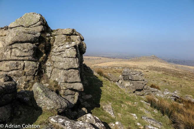
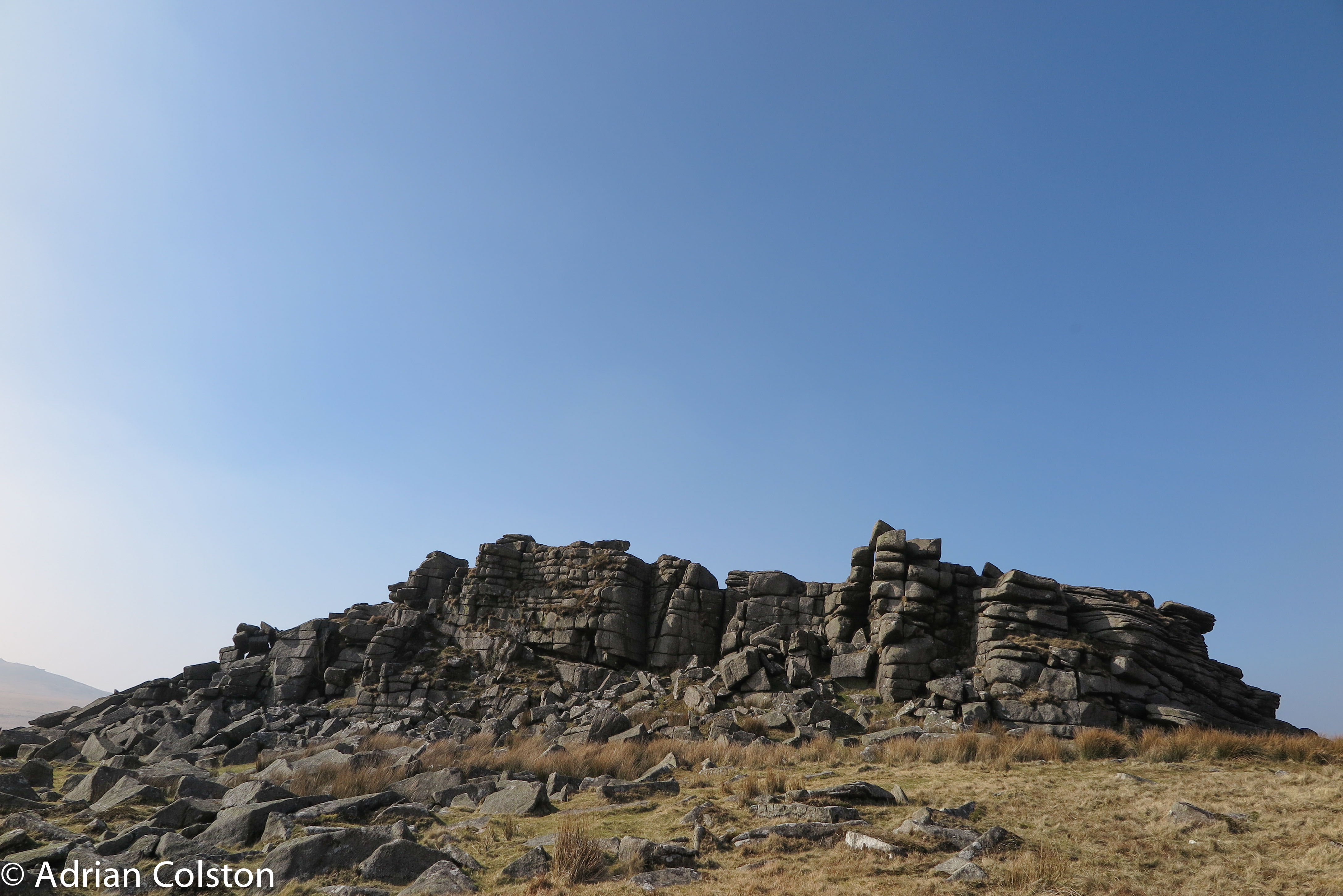
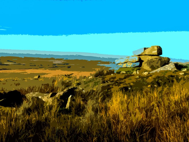
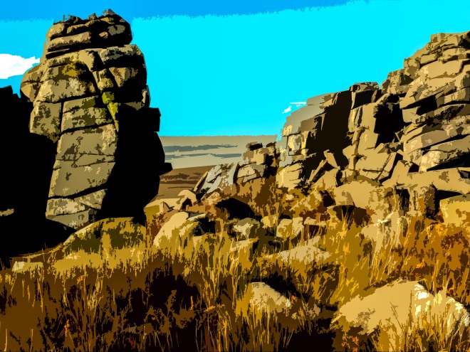
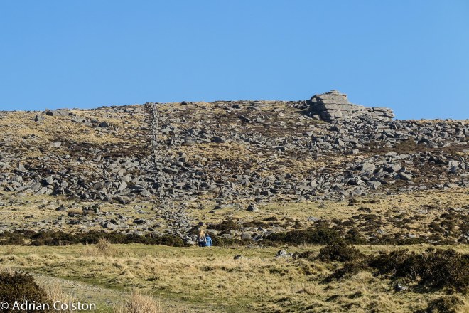
Belstone Tor is rather confusing as it is made up of at least three summits which could each in their own right be called a Tor. They all run along the ridge running south. On the second ‘tor’ looking back to the first

Belstone Tor 2
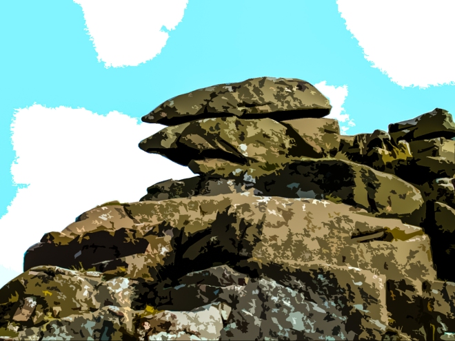
Another of the Belstone Tor outcrops – beautifully jointed.

Feather and Tare
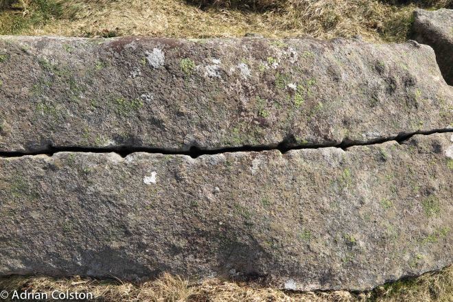
Belstone Tor is littered with granite boulders along its flanks and in the past attracted the attention of granite masons – here is a rock which has been split by a process  known as feather and tare. It was then never removed (reason unknown)

The Logan Stone

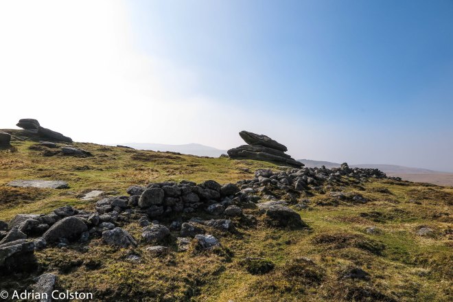
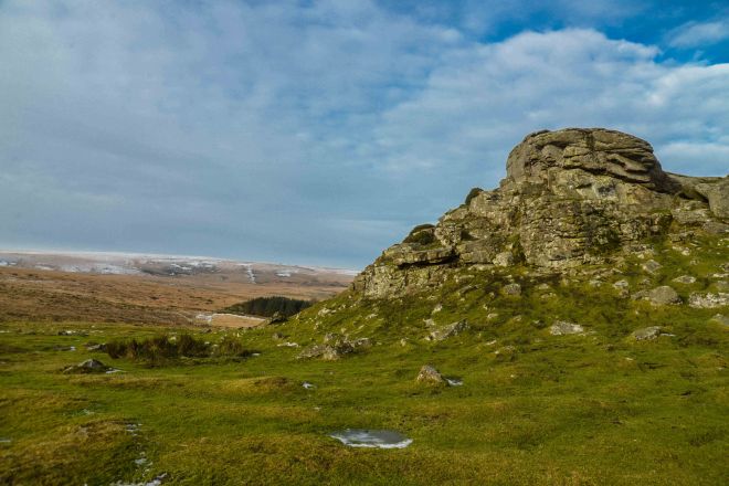
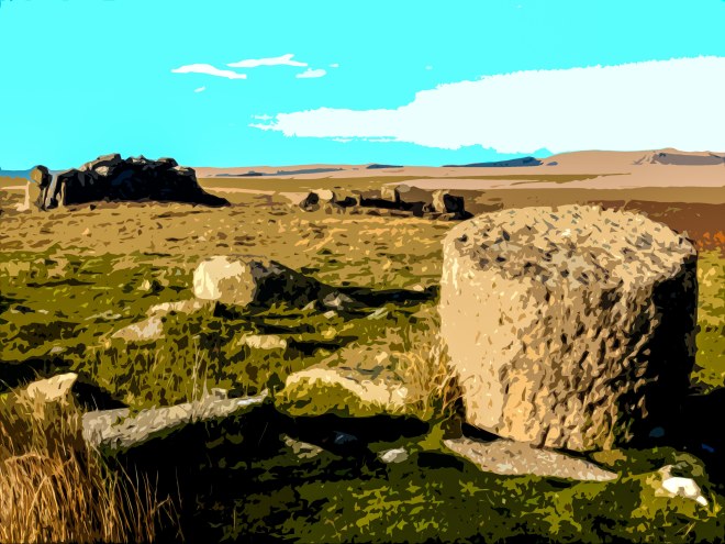
Moving further south you reach a dilapidated wall known as Irishman’s Wall – in the middle of the picture is a solitary granite outcrop which is a logan stone i.e. the top bit ‘rocks’ on the lower piece (see here for more details of how they were formed).

Irishman's Wall
Another view of Irishman’s Wall – this wall was indeed built by Irish workers who were trying to enclose the land and therefore steal it from the local Commoners – full story here. The Commoners were having none of it and pushed sections of it down. The project was then abandoned.

Higher Tor
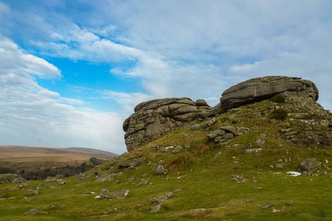
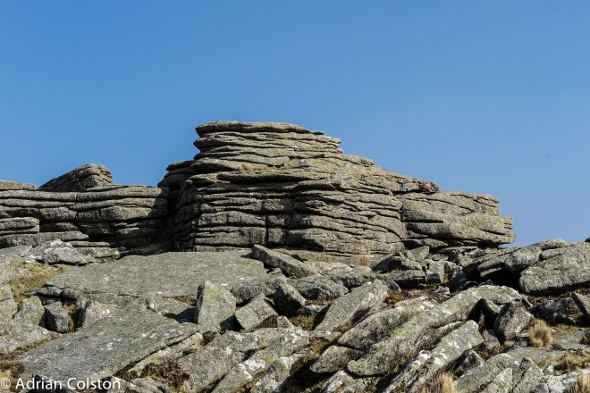
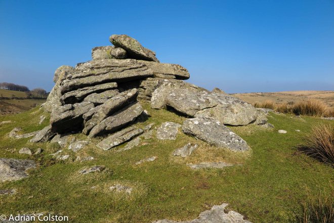
On from the logan stone and the Wall you quickly reach Higher Tor

Higher Tor 2
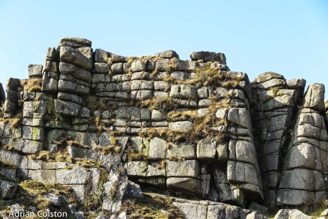
Again fabulous jointing

Herdwick Sheep

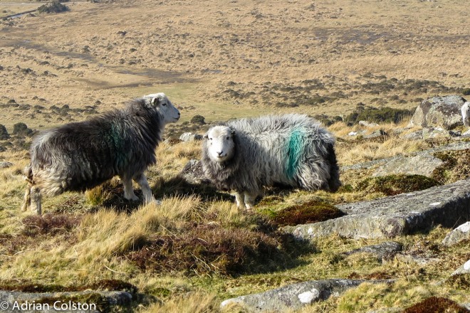
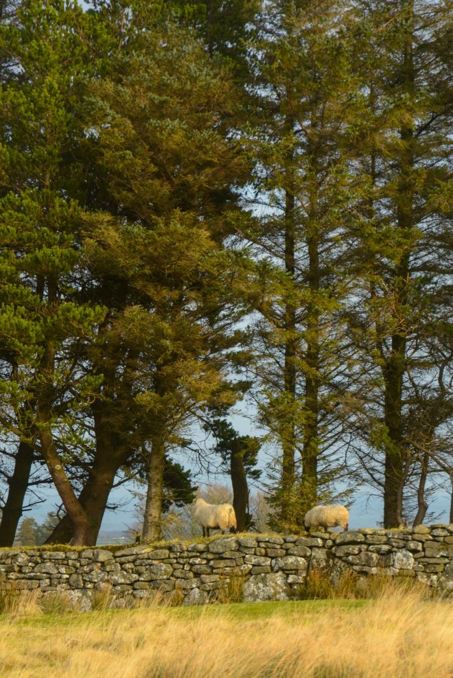
Belstone Common is currently home to a flock of Herdwick sheep – the sheep of the Lake District recently made very famous by James Rebanks in his excellent book ‘The Shepherd’s Life’ – definitely worth a read – see here.

Irishman's Wall 2
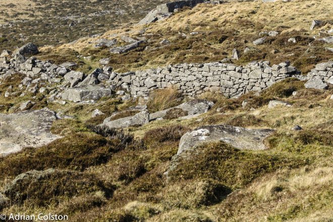
You then walk down off the ridge towards Cullever Steps – look back up the hill and you can see Irishman’s Wall again.

Scary Tor
Finally head over to Scary Tor near the Steps before picking up the obvious track which will take you back to Belstone.

After you have done the walk why not drop into The Tors public house for a pint!


Kestor and Scorhill

Spent a great day up on the high moor yesterday checkpointing our 10 Tors training teams

Kes Tor1
Started off at Kestor high above Chagford – you can see the snow on the ridge leading up to Watern Tor

Kes Tor
The Legendary Dartmoor website recently posted a piece about Kestor and the possible derivation of its name – see here. Over the years it has been known as Kestor, Kestor Rocks, Kes Tor, Castor – all of which might have been a mis-spelling of the local dialect – maybe it is in fact Cats Tor – a reference to a long gone past when wild cats used to live in the area…. another lost and forgotten Dartmoor species which I call ghosts in the landscape

Sheep
Despite all the effort that has gone into building and the maintaining that stone wall …

Clapper
This is the clapper bridge over the North Teign river

Teign
The point where the Teign really starts to descent from the moor

Scorhill1
Just around the corner is Scorhill – a brilliant stone circle

Scorhill2
Again the Legendary Dartmoor website throws some light onto the many theories, myths and legends surrounding Scorhill – see here – the adder anecdote is very interesting……

Ponies 2
And finally back to Kestor looking south over Fernworthy Forest

Ponies 1
With Thornworthy Tor in the foreground

A great day out – although the temperature was low there wasn’t much of a wind so fortunately it didn’t fell cold.


Digital maps from the Ordnance Survey

When you buy an Ordnance Survey Map now it also comes with a free mobile download of the same map

OS map 1

It is easy to download from the OS site you just need to set up an account (free of charge) and then enter the code that comes with the map and then download it to your phone – either and iPhone or an Android.

OS map 2
And then you have a 1:25,000 map on your iPhone with full GPS functionality – i.e. your phone will show you exactly where you are. You can also plot routes to follow are record exactly where you have been.

Brilliant.

The Tors of the NT’s Upper Plym property

If you park your car past Cadover Bridge near to where the Blacka Brook joins the River Plym (SX563644) you can start a walk which takes you around the National Trust’s 3300 acre Upper Plym property – its a good 10 mile walk on the high moor so you need a compass, map, walking boots and warm waterproof clothes. It isn’t a beginner’s walk and it will take you at least 4 hours. If you do do it though you will be rewarded with some of Dartmoor’s fabulous but lesser known Tors. Here are some photographs of those Tors which I taken over the years and have now turned into ‘screen print images’ via Photoshop.

Hexton Tor
Hexton Tor near to Trowlesworthy Farm with Little and Great Trowlesworthy Tors on the skyline. It is not named on the OS 1:25,000 map – its grid reference is SX566649 – all the other Tors I mention are.

Little Trowlesworthy Tor
Little Trowlesworthy Tor with the abandoned worked granite flagpole base in the foreground

Greater Trowlesworthy Tor-cutoutPart of Great Trowlesworthy Tor near the quarry

Shell Top
Up the hill from there to the east is Shell Top

Hen Tor cutout
Back down the slope to the north west is Hen Tor

Shavercomber Tor
Go north again and you will get to Shavercombe Tor

Calverslake Tor
To the north east is Calverslake Tor near the source of the Plym (you make recognise this photo from my blog header!)

Quickest way back is to follow the Plym south (downstream)  all the way back to the Blacka Brook.

Alternatively you could start at Peat Cot (c2 miles SE of Princetown near Whiteworks) and walk past Nunn’s Cross and then do the Tors the other way round. A longer walk and one that needs more advanced navigation skills.

We regularly take our 10 Tors training walks on both these routes – they are character building too!

(All the images are my copyright)

Smart new Welcome Signs at Fingle and Parke

The National Trust is introducing new Welcome Signs at all of its most visited outdoors sites. The idea of them is to welcome visitors to our places, orientate them, give them a little information about the site and give information on things that are going on. We have just received our first two signs for Parke and Fingle Bridge. More will follow soon!

Finglesign3
The sign at Parke in the car park

Finglesign2
At Fingle Bridge we also have these ‘boundary’ markers telling you that you have arrived

Finglesign1
The sign at Fingle Bridge also introduces our partnership with the Woodland Trust at Fingle Woods